17 NOV 2012: People still clicking on to this page, please note this is now well out of date!
Large areas of Cork city and county are under several feet of water this morning, after a night of heavy rain.
(Image: rte.ie) Heavy flooding along Clarke St and Casement St in Clonakilty, Co Cork (Click image for source)
Douglas Village was left under two feet of water after the torrential downpour. Other badly affected areas include, include Togher, the Kinsale Road, the South Ring Road, Blackpool, Clonakilty and Ballyvolane.
Some parts of the city have been left without electricity. ESB Networks is appealing toresidentsall over Cork to conserve electricity today, as they try to get customers back online after power outages caused by flooding. full story
Heavy rain has also caused flooding in other areas of the country, including Kildare, Westmeath, Tipperary and the North.
Met Eireann has issued a flood alert to more than a dozen county councils with 70mm of rain forecast to fall in parts of Munster, Connacht, south Leinster and the midlands up to noon today.
Gardai in Anglesea Street wish to advise motorists of the following traffic restrictions:
City Centre in Cork – is passable.
Douglas – passable, heavy traffic and water is subsiding.
Blackpool – both sides of the Church impassable.
Mallow Road – passable.
Sarfields Roundabout – impassable.
Viaduct – a stop & go system is in operation.
Glanmire – impassable.
Thursday, 28 June, 2012 at 11:30 (11:30 AM) UTC RSOE
(Photo: Roger Price, Creative Commons Licence) “Fabulous view from the office with Typhoon Doksuri approaching!” says Roger Price who took this 8 hours ago in Soho, Hong Kong, Hong Kong Island, HK, using an Apple iPhone 4S.
At least 14 people were killed, mostly police officers, and another 53 were injured in an early morning highway crash Tuesday involving two packed police buses and a cargo truck in Argentina’s southern Patagonia region, local media said.
The accident occurred along a stretch of National Highway No. 3 in the Patagonian province of Chubut just before 6:45 a.m. local time, when a truck carrying cereals crashed into the police buses, which were bringing the officers back from a security operation at an oil field.
The police were headed first to the town of Puerto Madryn, about 65 kilometres from the accident site, and later back to their bases in the provinces of Buenos Aires and Santa Fe, some 1, 330 kilometres to the north.
Images provided by the daily El Chubut showed one of the police buses mangled almost beyond recognition and the roadway covered in what appeared to be the truck’s spilled cargo.
(Image: publica.elchubut.com.ar) Patagonia crash (Click image for source)
The truck driver and both police bus drivers were confirmed to be among the dead.
The injured were taken to a hospital in nearby Puerto Madryn, and those in critical condition were to be transported to larger hospitals in the nearby city of Trelew and the provincial capital Rawson, rescue workers said.
The highway was closed to traffic while rescue teams removed the bodies and wreckage, and authorities tried to determine the cause of the crash.
Wednesday, 27 June, 2012 at 10:28 (10:28 AM) UTC RSOE
Seventeen people have been taken to a hospital after being struck by lightning at Sweden’s Peace and Love Music Festival.
Festival organizers set up a makeshift care center to begin transporting people to a local health facility near Borlänge, Central Sweden.
“First we saw a lightning flash and then we heard a really loud clap of thunder. The next thing we knew, the ambulances had come”
says witness Amanda Andersen to the Dagens Nyheter newspaper (quote via The Local).
Lightning struck the grounds around 3PM on Tuesday, just as the summer concert series was beginning. Rihanna, Mumford and Sons, Regina Spektor, Skrillex, Bloc Party and Billy Idol are just a few of the big-name performers.
The people involved have reportedly received only minor injuries, with most “up and walking.”
Wednesday, 27 June, 2012 at 03:25 (03:25 AM) UTC RSOE
More than 100 people are missing and about 30 confirmed dead in eastern Uganda after a landslide buried villages.
On Monday, the Uganda Red Cross said at least 18 people had been killed, but yesterday government officials said the number of fatalities was higher and that 109 people were still missing around Mt Elgon, a major coffee-growing area.
Heavy rain triggered a mudslide on Monday that cut through trees and bushes, burying two villages in mud, officials said, adding that 178 people had survived.
The search operation was called off yesterday officials said the chances of finding survivors were slim. “It is feared the landslide and floods buried about 29 homes with about 30 people dead,” said Stephen Mallinga, the minister of disaster preparedness and refugees.
He said the timing of the disaster – 2pm – had prevented more fatalities as many people were either at the market or at school.
Up to 400,000 people could require humanitarian aid as the rain intensified, forcing them to abandon their homes, he added.
Survivors fretted about the possibility of more landslides.
“I fear that the thing could come again and sweep me away. It happened in seconds. The trees were shaking and the soil was going down,” said 26-year-old Julius Wabuteya.
He said he had found his pregnant wife knee-deep in mud and had managed to pull her out and rush her to hospital to seek treatment for her injuries. Others were not so lucky.
Mary Lubango, who wailed in grief at the scene of the landslide, said she had lost several relatives when the landslide struck.
(Image: nj.com) A village woman mourns after a landslide in Uganda, June 26, 2012 (Click image for source)
Tuesday, 26 June, 2012 at 05:30 (05:30 AM) UTC RSOE
UPDATE: 28 June, 2012
Rescue workers in Uganda yesterday June 26 ended the search for the dead, concentrating on looking after the injured and displaced.
An estimated 450 people are believed to have been buried in massive landslides
on Monday June 25 in the villages of Namaga and Bunakasala, Bududa District in the eastern part of the country near Mount Elgon.
(Image: BBC) Uganda landslides: Sad picture speaks for itself…. (Click image for source)
The area was said to have experienced heavy rain for a number of days before Monday’s disaster struck.
Reports said only about 18 bodies had been recovered.
David Wakikona, a legislator from the region said most people were likely indoors when huge blocks of mud and rocks started to roll down hills, toppling homes, killing livestock and burying people alive. According to him, at least 300 people lived in the three affected villages.
A survivor, Rachael Namwono told Uganda’s Monitor newspaper that the ground quaked at 2 pm local time, followed by heavy rumbling of soil and stones which covered their home in the mountainous district.
Officials from Bududa confirmed that the final death toll would likely be in hundreds.
The Disaster Preparedness Minister, Stephen Mallinga said he also expected the death toll to rise as mud is removed from the affected villages, adding that moving the mud had so far proved difficult.
Minister Mallinga said many residents were refusing to move to safer locations as villages near Mount Elgon have fertile land and fewer cases of malaria.
He told the BBC that his government will eventually pass a law to relocate people from the top and sides of the mountain.
Even those who were relocated to a camp for refugees after the 2010 landslides secretly returned to Bududa, Mallinga explained.
A Red Cross official, Michael Nataka told Reuters news agency that the total number at risk in the buried areas was 448.
He said the Mount Elgon area has so many places with cracks and that each time there is prolonged rainfall, water seeps into the cracks, eventually causing landslides. Landslides are a common occurrence in the hilly parts of eastern Uganda.
They have been especially lethal over the years in villages where the land is denuded of vegetation cover.
Massive landslides in Bududa in 2010 killed about 100 people, destroying everything from the village market to a church.
A ship carrying about 150 people has sunk in the waters between Australia and Indonesia, the Australian Maritime Safety Authority said today (Wednesday).
(Image: shire.gov.cx) Christmas Island
Two merchant vessels are trying to rescue people where the ship went down, about 107 nautical miles north of Australia’s Christmas Island, the authority said.- CNN Wire
A boat carrying around 150 suspected asylum seekers has capsized off northwest Australia today, just a week after 90 people drowned on a similar journey.
Merchant ships are currently collecting survivors from the capsizing, which happened between Indonesia and Australia’s
Dozens of asylum seekers are feared drowned after a second boatload of capsized in less than a week in Australian waters today.
The frail wooden boat was estimated to have been carrying about 150 people and there were fears that many had drowned as rescuers were making their way to the scene of the tragedy.
Mr Mal Larsen, from the Australian Maritime Safety Authority said rescue ships were beginning to arrive at the scene and some people were being pulled from the water.
‘They are doing their best to pull people out,’ he said. ‘It’s too early to say how many have been saved.’
Update: At least one person died and Customs says 130 people have been rescued from the distressed boat.
Rescue authorities had been told by those aboard the vessel that its generator had stopped working and that the boat sank . – news.com.au
A crowded boat carrying asylum seekers to Australia capsized Wednesday and 125 survivors and one body were recovered from the Indian Ocean, less than a week after more than 90 people drowned on a similar journey. An air and sea search was ongoing for as many as 20 people who could still be missing, the Australian Maritime Safety Authority said. Three merchant ships that responded to the capsizing rescued 125 people, and the authority said one body was recovered. The area is midway between Christmas Island and the main Indonesian island of Java. The authority said up to 150 men, women and children may have been on the wooden Indonesian fishing boat. Prime Minister Julian Gillard told Parliament that two Australian warships and an air force aircraft that can drop life rafts on the sea joined the search by late Wednesday. The area is 200 kilometers (120 miles) north of Australia’s Christmas Island and 185 kilometers (115 kilometers) south of Java. The boat capsized in Indonesia’s search and rescue zone but Australian authorities had raised the alarm, Australian Maritime Safety Authority spokeswoman Jo Meehan said.
The first merchant ship reached the scene more than four hours later, she said. Last Thursday, 110 people were rescued when a boat carrying more than 200 mostly Afghan asylum seekers capsized only 24 kilometers (15 miles) from the latest tragedy. Only 17 bodies were recovered. The survivors’ refugee applications were being assessed at Christmas Island, where Australia runs an immigration detention center. Australia is a common destination for boats carrying asylum seekers from Afghanistan, Iraq, Sri Lanka and other poor or war-torn countries. Last week’s disaster rekindled debate in Parliament on how Australia should deter asylum seekers from risking the hazardous sea journey. The government wants to send new boat arrivals to Malaysia in exchange for accepting U.N.-recognized refugees living there. The opposition won’t support the legislation because Malaysia has not signed the Refugee Convention.
Wednesday, 27 June, 2012 at 11:09 (11:09 AM) UTC RSOE
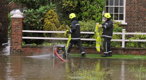
Torrential downpours have brought flooding to swaths of northern England, forcing people to leave their homes as more than a month’s worth of rain fell in 24 hours.
An 80-year-old man was hospitalised with serious internal injuries following a collision in heavy rain in the Scottish Borders on Friday afternoon.
In the West Yorkshire village of Mytholmroyd, the river Calder burst its banks at about 9pm, leaving many homes and businesses under water.
Simon Young, a local councillor, said it was “a pretty devastating picture. I’ve spoken to a lot of people, a lot of whom have lived in the area for years, and they cannot remember anything like this in the last 24 years. It’s going to be a pretty big clean-up operation.”
The deluges also battered revellers at the Isle of Wight Festival and brought havoc to Cumbria which buckled under the worst of the wet weather. Up to 100mm of rain hit the region overnight, while south-west Scotland, Northern Ireland and Lancashire also experienced unusually heavy rainfall.
The Environment Agency issued around 140 flood warnings and alerts in northern regions which are also subject to Met Office severe weather warnings. Some families spent the night in temporary accommodation after they were evacuated from properties in Lancashire when rivers burst their banks.
They were taken to the nearby Darwen Leisure Centre after fleeing homes in Croston and Darwen, near Chorley, but were expected to return today.
In Wigan, fire crews helped a number of residents leave their homes using a rescue boat after waist-deep water flooded homes and the RSPCA called firefighters to assist in the rescue of a number of animals from a flooded allotment, including six horses and four dogs.
Forecasters said water levels would begin to recede but further showers are expected to slow the clear-up process, meaning some areas will remain swamped.
However, the adverse conditions are set to improve – with the possibility of sunshine for festival-goers on Sunday.
Matt Dobson, senior forecaster at MeteoGroup, the weather division of the Press Association, said Borrowdale in Cumbria bore the brunt of the bad weather, with an estimated 100mm of rain.
“It has been exceptionally wet overnight across Cumbria,” he said.
“By the end of the night, it is fair to say that probably 70mm-100mm fell over 24 hours which is a month’s worth of rain. It looks like the worst is probably now over for Cumbria.
There will still be some showers today and overnight but it is not going to be anywhere near as bad as it has been.
The worst weather today is going to be across Scotland, where there is likely to be further heavy rain or thunder storms.
But the good news is the Isle of Wight is likely to have a dry day.”
Rain brought chaos to parts of the country yesterday, flooding more than 70 homes.
Croston was said to have become an “island” and homes were evacuated as the local authority handed out sandbags and a shelter was set up at the village’s Bishop Rawstorne School.
Localised flashflooding also hit households in Greater Manchester where water was said to be waist height in some areas.
Firefighters were called in to clear floodwater in Wigan, helping three people and a dog away from their properties by boat.
The Olympic torch relay was also hit by the weather with organisers forced to cancel an outdoor event in Blackpool.
But the outlook is more promising in the coming days.
A band of wet weather is expected to sweep the country tonight, moving from West to East.
Forecasts suggest it will pass relatively quickly, meaning no one place should see more than five hours of rain.
Amounts of between 10mm-15mm are expected to fall quite widely before clearing in many areas today, with much of the country expected to see a dry day on Monday.
Sunday, 24 June, 2012 at 05:08 (05:08 AM) UTC RSOE
N Atlantic: Storm Alert issued at 27 Jun, 2012 9:00 GMT
Tropical Depression DEBBY (AL04) is forecast to strike land to the following likelihood(s) at the given lead time(s): Yellow Alert Country(s) or Province(s)
the United States
probability for TS is 90% currently
Yellow Alert City(s) and Town(s) Orlando (29.0 N, 81.5 W)
probability for TS is 55% currently
Note that
Yellow Alert (Elevated) is CAT 1 or above to between 10% and 30% probability, or TS to above 50% probability.
CAT 1 means Hurricane strength winds of at least 74 mph, 119 km/h or 64 knots 1-min sustained.
TS means Tropical Storm strength winds of at least 39 mph, 63 km/h or 34 knots 1-min sustained.
N Atlántico: Alerta de tormenta emitido al 27 de junio 2012 09:00 GMT
Tropical DEBBY Depresión (AL04) se prevé que la huelga de la tierra a la probabilidad siguiente (s) en el plazo de entrega determinado (s):
País alerta amarilla (s) o de la Provincia (s)
los Estados Unidos
probabilidad de TS es del 90% en la actualidad
Amarillo Ciudad Alerta (s) y Ciudad (s) Orlando (29,0 N, 81,5 W)
probabilidad de TS es del 55% en la actualidad
Nótese que
Alerta amarilla (elevada) es CAT 1 o superior a entre 10% y 30% de probabilidad, o TS anteriormente probabilidad del 50%.
CAT 1 significa que vientos huracanados de fuerza de por lo menos 74 mph, 119 km / ho 64 nudos 1-min sostenida.
TS significa vientos fuerza de tormenta tropical de al menos 39 mph, 63 km / ho 34 nudos 1-min sostenida.
BULLETIN
TROPICAL DEPRESSION DEBBY ADVISORY NUMBER 16
NWS NATIONAL HURRICANE CENTER MIAMI FL AL042012
500 AM EDT WED JUN 27 2012
…DEBBY BECOMING LESS ORGANIZED AS IT REACHES THE EAST COAST OF
NORTH-CENTRAL FLORIDA…
SUMMARY OF 500 AM EDT…0900 UTC…INFORMATION
———————————————-
LOCATION…29.6N 81.0W
ABOUT 25 MI…45 KM SE OF ST. AUGUSTINE FLORIDA
MAXIMUM SUSTAINED WINDS…35 MPH…55 KM/H
PRESENT MOVEMENT…ENE OR 75 DEGREES AT 10 MPH…17 KM/H
MINIMUM CENTRAL PRESSURE…998 MB…29.47 INCHES
WATCHES AND WARNINGS
——————–
THERE ARE NO COASTAL WATCHES OR WARNINGS IN EFFECT.
DISCUSSION AND 48-HOUR OUTLOOK
——————————
AT 500 AM EDT…0900 UTC…THE CENTER OF TROPICAL DEPRESSION DEBBY
WAS LOCATED NEAR LATITUDE 29.6 NORTH…LONGITUDE 81.0 WEST. THE
DEPRESSION IS MOVING TOWARD THE EAST-NORTHEAST NEAR 10 MPH…17
KM/H. THIS GENERAL MOTION IS EXPECTED DURING THE NEXT DAY OR TWO
WITH SOME INCREASE IN FORWARD SPEED. ON THE FORECAST TRACK…DEBBY
SHOULD GRADUALLY MOVE AWAY FROM FLORIDA TODAY.
MAXIMUM SUSTAINED WINDS ARE NEAR 35 MPH…55 KM/H…WITH HIGHER
GUSTS. LITTLE CHANGE IN STRENGTH IS FORECAST DURING THE NEXT 48
HOURS.
ESTIMATED MINIMUM CENTRAL PRESSURE IS 998 MB…29.47 INCHES.
HAZARDS AFFECTING LAND
———————-
STORM SURGE…ELEVATED WATER LEVELS IN AREAS OF ONSHORE FLOW ALONG
THE SOUTHWESTERN AND NORTHEASTERN COASTS OF FLORIDA SHOULD SUBSIDE
LATER TODAY. FOR INFORMATION SPECIFIC TO YOUR AREA…PLEASE SEE
PRODUCTS ISSUED BY YOUR LOCAL NATIONAL WEATHER SERVICE OFFICE.
RAINFALL…RAINFALL ASSOCIATED WITH DEBBY WILL CONTINUE TO DIMINISH
ACROSS THE FLORIDA PENINSULA TODAY. ADDITIONAL ISOLATED RAINFALL
AMOUNTS OF UP TO ONE INCH WILL BE POSSIBLE IN SOME OF THE LINGERING
RAIN BANDS…MAINLY OVER SOUTHERN FLORIDA.
NEXT ADVISORY
————-
NEXT COMPLETE ADVISORY…1100 AM EDT.
$$
FORECASTER AVILA
000
WTCA44 TJSJ 270931
TCPSP4
BOLETIN
DEPRESION TROPICAL DEBBY ADVERTENCIA NUMERO 16
NWS CENTRO NACIONAL DE HURACANES MIAMI FL AL042012
TRADUCCION EMITIDA POR SERVICIO NACIONAL DE METEOROLOGIA SAN JUAN PR
500 AM EDT MIERCOLES 27 DE JUNIO DE 2012
…DEBBY MENOS ORGANIZADA MIENTRAS ALCANZA LA COSTA ESTE DEL NORTE
CENTRAL DE FLORIDA…
RESUMEN DE LAS 500 AM EDT…0900 UTC…INFORMACION
————————————————–
LOCALIZACION…29.6 NORTE 81.0 OESTE
CERCA DE 25 MI…45 KM AL SURESTE DE ST. AUGUSTINE FLORIDA
VIENTOS MAXIMOS SOSTENIDOS…35 MPH…55 KM/H
MOVIMIENTO ACTUAL…ESTE NORESTE O 75 GRADOS A 10 MPH…17 KM/H
PRESION CENTRAL MINIMA…998 MB…29.47 PULGADAS
VIGILANCIAS Y AVISOS
——————–
NO HAY VIGILANCIAS O AVISOS COSTEROS EN EFECTO.
DISCUSION Y PERSPECTIVAS PARA LAS PROXIMAS 48 HORAS
—————————————————
A LAS 5:00 AM EDT…0900 UTC…EL CENTRO DE LA DEPRESION TROPICAL
DEBBY ESTABA LOCALIZADO CERCA DE LA LATITUD 29.6 NORTE…LONGITUD
81.0 OESTE. LA DEPRESION SE ESTA MOVIENDO HACIA EL ESTE NORESTE A
CERCA DE 10 MPH…17 KM/H. SE ESPERA QUE CONTINUE ESTE MOVIMIENTO
DURANTE LOS PROXIMOS DIAS CON UN AUMENTO EN LA VELOCIDAD DE
TRASLACION. EN LA TRAYECTORIA PRONOSTICADA…DEBBY DEBERA ALEJARSE
GRADUALMENTE DE FLORIDA HOY.
VIENTOS MAXIMOS SOSTENIDOS ESTAN CERCA DE 35 MPH…55 KM/H…CON
RAFAGAS MAS ALTAS. SE PRONOSTICA POCO CAMBIO EN SU INTENSIDAD
DURANTE LAS PROXIMAS 48.
LA PRESION MINIMA CENTRAL ESTIMADA ES DE 998 MB…29.47 PULGADAS.
PELIGROS AFECTANDO TIERRA
————————-
MAREJADA CICLONICA…NIVELES ALTOS DE AGUA EN AREAS DONDE LAS AGUAS
NORMALMENTE FLUYEN SOBRE LA COSTA A LO LARGO DE LAS COSTAS DEL
SUROESTE Y NORESTE DE FLORIDA DEBEN DISMINUIR MAS TARDE HOY. PARA
INFORMACION ESPECIFICA EN SU AREA…FAVOR DE REFERIRSE A LOS
PRODUCTOS EMITIDOS POR SU OFICINA LOCAL DEL SERVICIO NACIONAL DE
METEOROLOGIA.
LLUVIA…SE ESPERA QUE LAS LLUVIAS ASOCIADAS A DEBBY CONTINUEN
DISMINUYENDO A TRAVES DE LA PENINSULA DE FLORIDA MAS TARDE HOY.
CANTIDADES AISLADAS ADICIONALES DE HASTA UNA PULGADA SON POSIBLES EN
LAS BANDAS EXTERIORES DE DEBBY…MAYORMENTE SOBRE EL SUR DE FLORIDA.
PROXIMAS ADVERTENCIAS
———————
PROXIMA ADVERTENCIA COMPLETA…1100 AM EDT.
$$
PRONOSTICADORES AVILA
000
WTNT44 KNHC 270832
TCDAT4
TROPICAL DEPRESSION DEBBY DISCUSSION NUMBER 16
NWS NATIONAL HURRICANE CENTER MIAMI FL AL042012
500 AM EDT WED JUN 27 2012
SATELLITE…RADAR AND SURFACE OBSERVATIONS INDICATE THAT THE
CIRCULATION OF DEBBY IS INCREASINGLY BECOMING ELONGATED. THE CENTER
IS DIFFICULT TO LOCATE GIVEN THE LACK OF ORGANIZATION…BUT THE AREA
OF MINIMUM PRESSURE HAS BEEN MOVING EAST-NORTHEASTWARD OR 075
DEGREES AT 9 KNOTS ACROSS NORTH-CENTRAL FLORIDA. MOST OF THE DEEP
CONVECTION IS IN A FRONTAL-TYPE BAND EXTENDING NORTHEASTWARD FROM
FLORIDA ACROSS THE ADJACENT ATLANTIC. THE MAXIMUM WINDS ARE STILL
PROBABLY 30 KNOTS IN A FEW SQUALLS MAINLY OVER WATER.
NONE OF THE INTENSITY GUIDANCE SHOW A SIGNIFICANT INCREASE IN
STRENGTH…AND IN FACT…BOTH THE GFS AND THE ECMWF SUGGEST
WEAKENING IN THE 00 UTC RUN. THE OFFICIAL FORECAST KEEPS DEBBY AS A
TROPICAL DEPRESSION AND ALLOWS SOME SLIGHT STRENGTHENING BEYOND 3
DAYS.
DEBBY IS EMBEDDED IN WESTERLY FLOW WITHIN THE BASE OF A MID-LATITUDE
TROUGH…AND IT SHOULD CONTINUE TO MOVE TOWARD THE EAST-NORTHEAST OR
NORTHEAST AS INDICATED BY GLOBAL MODELS. THE OFFICIAL FORECAST IS
IN BETWEEN THE GFS AND ECMWF MODELS.
DEBBY DEPRESION TROPICAL NÚMERO 16 DE DEBATE
NWS CENTRO NACIONAL DE HURACANES MIAMI FL AL042012
500 AM EDT MIERCOLES 27 de junio 2012
Las observaciones de radar … Y SATÉLITE superficie indica que el
CIRCULACIÓN DE DEBBY es cada vez más alargada. EL CENTRO
Es difícil de localizar Dada la falta de organización … PERO LA ZONA
DE PRESION MINIMA SE ESTA MOVIENDO HACIA EL NORESTE O ESTE-075
GRADOS a 9 nudos en el noreste de la Florida Central. LA MAYORÍA DE LAS PROFUNDIDADES
CONVECCIÓN está en una banda tipo frontal AMPLIACIÓN DEL NORESTE
A TRAVES DE LA FLORIDA Atlántico adyacente. LOS VIENTOS MAXIMOS SON TODAVÍA
Probablemente 30 nudos con una TURBONADAS PRINCIPALMENTE sobre el agua.
NINGUNA DE LAS DIRECTRICES DE INTENSIDAD muestran un aumento significativo EN
Fuerza … Y, de hecho … Tanto el modelo GFS y ECMWF dan a entender
Debilitamiento en el RUN 00 UTC. El pronóstico oficial DEBBY MANTIENE COMO
DEPRESION TROPICAL Y PERMITE ALGUN FORTALECIMIENTO LEVE más allá de 3
DÍAS.
DEBBY está incrustado en flujo del oeste dentro de la base A MEDIADOS DE LA LATITUD
A TRAVÉS DE … y debe seguir para avanzar en la ESTE-NORESTE O
NORESTE DE LO INDICADO POR LOS MODELOS GLOBALES. LA PREVISIÓN OFICIAL
En medio de la GFS y ECMWF MODELOS.
A man has been captured on film using a wind created by tropical storm Debby to leap over an entire pier at Redington Beach, Florida, according to the Telegraph.
The gale-force winds, which have been measuring up to 50 miles per hour, lift him totally clear of the structure.
The video was taken by onlooker Jay Gartner, who uploaded it onto YouTube on Sunday, and it has since been viewed over 300,000 times. – AOL
Tropical Storm TALIM (06W) is forecast to strike land to the following likelihood(s) at the given lead time(s):
Yellow Alert Country(s) or Province(s)
��� Taiwan
������� probability for TS is 100% currently
��� China
������� probability for TS is 90% currently
Yellow Alert City(s) and Town(s)
��� T’aichung (24.1 N, 120.7 E)
������� probability for TS is 95% currently
��� Taipei (25.0 N, 121.5 E)
������� probability for TS is 85% within 12 hours
��� Putian (25.6 N, 119.0 E)
������� probability for TS is 55% currently
Note that
��� Yellow Alert (Elevated) is CAT 1 or above to between 10% and 30% probability, or TS to above 50% probability.
��� CAT 1 means Typhoon strength winds of at least 74 mph, 119 km/h or 64 knots 1-min sustained.
��� TS means Tropical Storm strength winds of at least 39 mph, 63 km/h or 34 knots 1-min sustained.
Tropical Depression TALIM (CARINA) decaying over the East China Sea as it is being absorbed by strong frontal system.
TALIM (CARINA) will enhance the Southwest Monsoon (aka. Habagat) across Northwestern Luzon (from Ilocos Provinces down to La Union) incl. Benguet and Batanes. Breezy to windy conditions & cloudy skies w/ occasional to widespread rains, thunderstorms & squalls will be expected along these areas. The seas along the coastal areas along the South China and West Philippine Seas will be moderate to rough & dangerous.
*This is the last and final advisory on TALIM (CARINA).
Do not use this for life or death decision. This advisory is intended for additional information purposes only. Kindly refer to your country’s official weather agency for local warnings, advisories & bulletins.
Forecast Time�F2012/06/21 21:40
�@�@ EXTREMELY HEAVY RAIN ADVISORY
1. Taichung City-Changhua County-Nantou County-
Yunlin County-Chiayi City-Chiayi County-Tainan City-
Kaohsiung City-Pingtung County-Hengchun Peninsula-
...Heavy Rain Advisory or Extremely Heavy Rain
Advisory in effect from this evening (06/21) through
Friday night (06/22)...
2. Keelung North Coast-Taipei City-New Taipei City-
Taoyuan County-Hsinchu City-Hsinchu County-
Miaoli County-Yilan County-Hualien County-
Taitung County-
...Heavy Rain Advisory in effect from this evening
(06/21) through Friday night (06/22)...
------ Summary of Warning Areas ------
[Extremely Heavy Rain Advisory areas]
Taichung City-Changhua County-Nantou County-
Yunlin County-Chiayi City-Chiayi County-Tainan City-
Kaohsiung City-Pingtung County-Hengchun Peninsula-
[Heavy Rain Advisory areas]
Keelung North Coast-Taipei City-New Taipei City-
Taoyuan County-Hsinchu City-Hsinchu County-
Miaoli County-Yilan County-Hualien County-
Taitung County-
---- Observed Cumulative Rainfall ----
* Stations with 24H accumulated rainfall above 50mm
2012/06/20 20:40 PM ~ 2012/06/21 20:40 PM
-Extremely Heavy Rain (130mm):
Pingtung County Chunri Township: 193.0 mm,
Hualien County Xiulin Township: 154.0 mm,
Kaohsiung City Taoyuan District: 150.0 mm,
Nantou County Ren'ai Township: 141.0 mm
-Heavy Rain (50mm):
Pingtung County Wanluan Township: 110.5 mm,
Pingtung County Sandimen Township: 98.0 mm,
Pingtung County Fangliao Township: 96.5 mm,
Taichung City Heping District: 95.5 mm,
Pingtung County Chaozhou Township: 92.5 mm,
Pingtung County Majia Township: 89.0 mm,
Pingtung County Wutai Township: 85.0 mm,
Pingtung County Fangshan Township: 85.0 mm,
Chiayi County Alishan Township: 84.0 mm,
Pingtung County Nanzhou Township: 83.5 mm,
Tainan City Qigu District: 80.0 mm,
Tainan City Jiali District: 79.5 mm,
Miaoli County Houlong Township: 78.0 mm,
Kaohsiung City Liugui District: 73.5 mm,
Nantou County Xinyi Township: 72.5 mm,
Pingtung County Hengchun Township: 72.0 mm,
Miaoli County Dahu Township: 71.5 mm,
Kaohsiung City Namaxia District: 70.0 mm,
Taitung County Haiduan Township: 68.5 mm,
Miaoli County Zaoqiao Township: 68.0 mm,
Kaohsiung City Xinxing District: 65.5 mm,
Miaoli County Nanzhuang Township: 64.5 mm,
Pingtung County Neipu Township: 64.0 mm,
Miaoli County Miaoli City: 63.0 mm,
Pingtung County Donggang Township: 63.0 mm,
Kaohsiung City Xiaogang District: 62.0 mm,
Kaohsiung City Daliao District: 61.5 mm,
Kaohsiung City Qianzhen District: 61.5 mm,
Hsinchu County Xiangshan District: 61.0 mm,
Miaoli County Xihu Township: 61.0 mm,
Kaohsiung City Qijin District: 60.0 mm,
Kaohsiung City Fengshan District: 59.5 mm,
Miaoli County Zhunan Township: 59.0 mm,
Miaoli County Touwu Township: 58.5 mm,
Pingtung County Checheng Township: 58.5 mm,
Miaoli County Toufen Township: 58.0 mm,
Miaoli County Zhuolan Township: 58.0 mm,
Pingtung County Pingtung City: 57.0 mm,
Kaohsiung City Zuoying District: 56.0 mm,
Taichung City Shigang District: 55.5 mm,
Kaohsiung City Meinong District: 55.5 mm,
Taitung County Daren Township: 54.5 mm,
Tainan City Beimen District: 53.5 mm,
Miaoli County Sanwan Township: 53.5 mm,
Taichung City Fengyuan District: 52.5 mm,
Pingtung County Linluo Township: 50.5 mm,
Chiayi County Fanlu Township: 50.5 mm,
Pingtung County Manzhou Township: 50.0 mm
Chinese:
极�[�\�J��询
预报时间�F2012�N6��21��21:40
极�[�\�J��询
1�B�䒆�s�C����县�C�쓊县
�]��县�C��义�s�C��义县�C���s
���Y�s�C��东县�P�t��岛
...�Z暂时间�L阳����询������\�J
����晚�i06/21�j��过��询����
������晚��i06/22�j...
2�B��k�C�ݑ�k�s��k��
��园县�C�V�|�s�C�V�|县
�c�I县�C�X兰县�C��莲县
��东县
...�d���ʁC�����V晚��I�J��询
�i06/21�j������晚��i06/22�j......
------�E�v�x����------
[����\�J��询领��]
�䒆�s�C����县�C�쓊县
�]��县�C��义�s�C��义县�C���s
���Y�s�C��东县�P�t��岛
[晚间�L�J��询领��]
��k�C�ݑ�k�s��k��
��园县�C�V�|�s�C�V�|县
�c�I县�C�X兰县�C��莲县
��东县
----观�@��积�J��----
*�24��时��计�~�J��50mm�ȏ�
2012�N6��20��20时40���`2012�N6��21��20时40时
����\�J�i��130mm�j�F
��东县�t��乡�F193.0�|�āC
��莲县�G��乡�F154.0�|�āC
���Y�s������F150.0�|�āC
�쓊县�m爱乡�F141.0�|��
- ��J�i50�|�āj�F
��东县��峦乡�F110.5�|�āC
��东县�O�n门乡�F98.0�|�āC
��东县�c��乡�F96.5�|�āC
�䒆�s�a����F95.5�|�āC
��东县���B乡�F92.5�|�āC
��东县玛��乡�F89.0�|�āC
��东县雾��乡�F85.0�|�āC
��东县�c�R乡�F85.0�|�āC
��义县�����R乡�F84.0�|�āC
��东县��B乡�F83.5�|�āC
���s���Ë�F80.0�|�āC
���s������F79.5�|�āC
�c�I县�@龙镇�F78.0�|�āC
���Y�s�Z龟��F73.5�|�āC
�쓊县�M义乡�F72.5�|�āC
��东县�P�t镇�F72.0�|�āC
�c�I县���乡�F71.5�|�āC
���Y�s��玛�ċ�F70.0�|�āC
��东县�C�[乡�F68.5�|�āC
�c�I县Zaoqiao乡�F68.0�|�āC
���Y�s�V兴��F65.5�|�āC
�c�I县�쏯乡�F64.5�|�āC
��东����乡�F64.0�|�āC
�c�I县�c�I�s�F63.0�|�āC
��东县�`镇�F63.0�|�āC
���Y�s���`�n��F62.0�|�āC
���Y�s�嗾��F61.5�|�āC
���Y�s�O镇��F61.5�|�āC
�V�|县���R��F61.0�|�āC
�c�I县����乡�F61.0�|�āC
���Y�s���Ë�F60.0�|�āC
���Y�s凤�R��F59.5�|�āC
�c�I县�|��镇�F59.0�|�āC
�c�I县头��乡�F58.5�|�āC
��东县车��乡�F58.5�|�āC
�c�I县头份镇�F58.0�|�āC
�c�I县��兰镇�F58.0�|�āC
��东县��东�s�F57.0�|�āC
���Y�s��营��F56.0�|�āC
�䒆�s��冈��F55.5�|�āC
���Y�s��浓��F55.5�|�āC
��东县达�m乡�F54.5�|�āC
���s�k门��F53.5�|�āC
�c�I县�O�p乡�F53.5�|�āC
�䒆�s丰����F52.5�|�āC
��东县�ٗ�乡�F50.5�|�āC
��义县�ԘH乡�F50.5�|�āC
��东县满�B乡�F50.0�|��
�LIVE WEBCAMS
Tropical Storm GUCHOL (05W) is forecast to strike land to the following likelihood(s) at the given lead time(s):
Yellow Alert Country(s) or Province(s)
Japan
probability for TS is 85% currently
Yellow Alert City(s) and Town(s)
Nagoya (35.2 N, 136.9 E)
probability for TS is 80% currently
Note that
Yellow Alert (Elevated) is CAT 1 or above to between 10% and 30% probability, or TS to above 50% probability.
CAT 1 means Typhoon strength winds of at least 74 mph, 119 km/h or 64 knots 1-min sustained.
TS means Tropical Storm strength winds of at least 39 mph, 63 km/h or 34 knots 1-min sustained.
For graphical forecast information and further details please visit http://www.tropicalstormrisk.com/北西太平洋:6月19日で発行された嵐のアラート、201212:00 GMT(最終警告)
(Image: JMA) Japan Radar (Click image for animation/source)
(Image: NOAA) Current MTSAT-2 Satellite Image (Click Image for source)
(Image: tropic.ssec.wisc.edu) North West Pacific Infra Red (IR) Satellite Image (Click Image for source)
�
Update 19 June 2012 at 1500 GMT/UTC:
“GUCHOL (BUTCHOY) downgraded to Tropical Storm as it starts making landfall along the coast of Southern Honshu near Tanabe, Japan…may become Extratropical later tonight.
Residents and visitors along Japan should closely monitor the progress of GUCHOL (BUTCHOY).
Do not use this for life or death decision. This advisory is intended for additional information purposes only. Kindly refer to your country’s official weather agency for local warnings, advisories & bulletins.
wtpn31 pgtw 190900
msgid/genadmin/joint typhoon wrncen Pearl Harbor hi//
subj/tropical cyclone warning//
rmks/
1. Tropical storm 05w (Guchol) warning nr 034
   downgraded from typhoon 05w
   02 active tropical cyclones in northwestpac
   Max sustained winds based on one-minute average
   wind radii valid over open water only
    ---
   warning position:
   190600z --- near 32.4n 134.7e
     movement past six hours - 040 degrees at 37 kts
     position accurate to within 025 nm
     position based on center located by a combination of
     satellite and radar
   present wind distribution:
   Max sustained winds - 055 kt, gusts 070 kt
   wind radii valid over open water only
   becoming extratropical
   radius of 050 kt winds - 025 nm northeast quadrant
                            025 nm southeast quadrant
                            025 nm southwest quadrant
                            025 nm northwest quadrant
   radius of 034 kt winds - 180 nm northeast quadrant
                            170 nm southeast quadrant
                            150 nm southwest quadrant
                            120 nm northwest quadrant
   repeat posit: 32.4n 134.7e
    ---
   forecasts:
   12 hrs, valid at:
   191800z --- 36.9n 138.6e
   Max sustained winds - 030 kt, gusts 040 kt
   wind radii valid over open water only
   extratropical
   vector to 24 hr posit: 035 deg/ 28 kts
    ---
   24 hrs, valid at:
   200600z --- 41.4n 142.7e
   Max sustained winds - 020 kt, gusts 030 kt
   wind radii valid over open water only
   extratropical
    ---
remarks:
190900z position near 33.5n 135.7e.
Tropical storm 05w (Guchol), located approximately 160 nm
south-southwest of Kyoto, Japan, has tracked northeastward at 37
knots over the past six hours. Maximum significant wave height at
190600z is 33 feet. Next warnings at 191500z, 192100z and 200300z.
Refer to tropical storm 06w (Talim) warnings (wtpn32 pgtw) for
six-hourly updates.    //
NEW typhoon 4 storm also in Fukushima Prefecture
Typhoon No. 4 injured more than 30 people NEW
NEW expanded to 260,000 households in Shizuoka power outage
NEW postponed all lines operated at the Yamanote Line
NEW evacuation instructions and recommendations in six provinces
NEW interruption in part DoCoMo · SB
Also special train after the last train JR Tokyo metropolitan area
Access Ranking
June 19,
June 18,
One week
Peak hours of wind and rain of the typhoon
Heavy rain in eastern West Metropolitan typhoon
“Blow up the home before”
The storm also Tokai, Kinki Metropolitan typhoon
The part of the Kochi storm typhoon 4
In the southern Kii Peninsula, the storm-ku, Kochi
To evacuate more than 10,000 people in Ishinomaki, Miyagi
(The news of the day)
Special WEB
In Egypt, “Spring” do they come
June 19 (Tues.)
Aiming spread “ultra-compact”
June 18 (Mon)
Brain death and organ transplant children’s issues
June 15 (Fri.)
Greece national dilemma re-election
June 14 (Thurs.)
To the highest level of past high eel
June 13 (Wed.)
NHK Special
Will be broadcast
General
Comprehensive General 19:00 30 minutes to 10 minutes at 9 pm Saturday 23 June 2012
Impact of infertility power Nippon (tentative)
Overall 58 minutes to 9 minutes total time 9:00 (Sunday) afternoon, June 24, 2012
Prosperity of ancient Egypt 3,000 years people of the British Museum a collection of the unknown is supported
When 56 minutes from 30 minutes to 7 at 7 pm Monday to Thursday every week Today’s Close-up
Will be broadcast
General
June 20, 2012 broadcast (Wed)
The Pursuit of the two-year agriculture – case Fukushima elucidate the mechanism pollution “Satoyama”
The Pursuit of the two-year agriculture – case Fukushima elucidate the mechanism pollution “Satoyama”
June 21, 2012 broadcast (Thursday)
Pending broadcast content
Pending broadcast content
More news
More than 30 people are injured typhoon 4
June 20, 13:00 minutes
At NHK, has together with it through the broadcasting station around at the time of 11 pm, in Shizuoka Prefecture prefabricated hut is destroyed in the wind under the influence of the typhoon, and become seriously ill unconscious man was in, Osaka, Shizuoka , at 12 and Aichi prefectures, 32 people are injured to suit.
According to the police and fire departments around the country in the Toda Numazu, Shizuoka Prefecture at around 9:30 pm Sun 19, prefabricated hut is destroyed in the wind, but was rescued by fire fighting men were in, and become a serious condition of unconsciousness , six-seater was in Shizuoka Prefecture.
In addition, Shimamoto-cho, Osaka, too 6:30 pm, seven people were injured in the Osaka scissors a finger in the front door of apartment 66-year-old woman closed in high winds, such as serious injury to the bones break .
In Tahara, Aichi Prefecture, at around 5 pm, and to the serious injury that cut across the finger to the door of the home 65-year-old man was locked in high winds, five people were injured in the Aichi Prefecture further.
In addition, three people in Shiga Prefecture, two people each, Gunma Prefecture, Gifu Prefecture, Wakayama Prefecture, Mie Prefecture, each one has been injured in Okinawa Prefecture to it in Kyoto, Hyogo Prefecture, in Kanagawa Prefecture further.
Also damage to the building
In Hiroshima Prefecture, at around 5:00 am Sun 19, sediment hill behind the house in the city of Fukuyama, part of the wall of a collapsed residential building has been broken over 10 meters in both length and width.
In addition, two buildings in Gunma Prefecture and Shizuoka Prefecture, part of a building 8 has been broken to fit each of a building in Kanagawa Prefecture, Shiga Prefecture, Nara Prefecture.
In addition, the building and 26 of Himeji City, Hyogo Prefecture, in addition to building 29 was flooded up to the floor of the building to suit each one, Yamanashi Prefecture, Mie Prefecture, Oita Prefecture, Hyogo Prefecture, Gunma Prefecture, Yamanashi Prefecture, Shizuoka Prefecture, Mie 67 building was flooded under the floor to suit Prefecture, Miyazaki Prefecture.
More than 10,000 people to evacuate Odawara society News Home
Major news
News What’s New
NEW ~ Kanto region of Fukushima Prefecture storm typhoon 4
More than 30 people are injured typhoon 4
NEW to acquire banking operations of Mizuho Brazil
NEW impact on transportation in the Tohoku region
NEW Sekinegawa Ibaraki more than water flooding risk
NEW canceled 20 days some empty bins
NEW spate of fallen trees in the city of Sendai
Access Ranking
June 20,
June 19,
One week
Peak hours of wind and rain of the typhoon
Fukushima Prefecture, Kanto – the storm is also typhoon 4
Fukushima Prefecture – Kanto storm typhoon 4
Also special train after the last train JR Tokyo metropolitan area
The strength of the wind and the peak of the typhoon
Postponed operation in the whole line Yamanote Line
No derailment injured Hakone Tozan
(The news of the day)
Special WEB
In Egypt, “Spring” do they come
June 19 (Tues.)
Aiming spread “ultra-compact”
June 18 (Mon)
Brain death and organ transplant children’s issues
June 15 (Fri.)
Greece national dilemma re-election
June 14 (Thurs.)
To the highest level of past high eel
June 13 (Wed.)
NHK Special
Will be broadcast
General
Comprehensive General 19:00 30 minutes to 10 minutes at 9 pm Saturday 23 June 2012
Impact of infertility power Nippon (tentative)
Overall 58 minutes to 9 minutes total time 9:00 (Sunday) afternoon, June 24, 2012
Prosperity of ancient Egypt 3,000 years people of the British Museum a collection of the unknown is supported
When 56 minutes from 30 minutes to 7 at 7 pm Monday to Thursday every week Today’s Close-up
Will be broadcast
General
June 20, 2012 broadcast (Wed)
The Pursuit of the two-year agriculture – case Fukushima elucidate the mechanism pollution “Satoyama”
The Pursuit of the two-year agriculture – case Fukushima elucidate the mechanism pollution “Satoyama”
June 21, 2012 broadcast (Thursday)
Pending broadcast content
Pending broadcast content
More news
More than 10,000 people to evacuate Odawara
June 19, 23:22 minutes
According to the Kanagawa Prefecture, Sanno river flowing through the city bridge in the vicinity of Oriental Kuno Odawara Odawara, has exceeded the water level there is a risk of dangerous flooding caused flooding in 50 minutes at 9 pm.
Odawara is there is a risk of flooding as water levels continue to rise, has issued an advisory evacuation of about 4,700 households Kuno district, about 1,800 to 10,000 people in 57 minutes at 9 pm.
You are invited to vigilance has been growing very strictly as the risk of flood, Kanagawa Prefecture.
[News]
Automatic search
(22 hours 42 minutes June 19) 625 households in Hamamatsu evacuation
(22 hours 42 minutes June 19) release evacuation of Tsu, Mie
(56 minutes at 21 June 19) to reduce the evacuation of about 70,000 people in Toyohashi
(June 19, 3:21 minutes) to evacuate 123,000 people in Toyohashi
(June 19, 23:20 minutes) to evacuate 2,200 households Kesennuma
At approximately 1759 GMT/UTC Prime Minister’s Office @ Kantei_Saigai (disaster information) tweeted:
Estimated eastward north of about 60 km west-southwest near Iwaki 2:00 <typhoon 4>. Future, go to the northeast the East, is expected to change during the day to extratropical cyclone off the coast of Sanriku. High tide in a wide range of northern Japan – East
Philippines Flooding: At least 2 dead as search for 61* swept away in Sarangani continues, 765 families evacuated
Search and rescue teams are the continuing the search for the 61* reported missing persons who were swept away by a flash flood in Sarangani Province Monday evening, June 11.
In a resolution approved by Glan Mayor James Victor Yap, the entire municipality of Glan was already declared under a state of calamity.
Yap said that the flash flood left an estimated P20-million damage on properties in the municipality with at least 30 houses totally destroyed.
He said that Vice-president Jejomar Binay had already committed 1,000 packs of relief goods for the affected families.
Aside from the provincial government and the neighboring municipalities, Sarangani Province Representative Manny Pacquiao also pledged financial support for the victims and for the search and rescue operations, Yap said.
Convergence and collaboration of rescue and relief operations between the local government, PNP, Philippine Army, Navy, Coast Guard and other disaster relief and rescue units are currently being conducted in the affected barangays in the municipalities of Glan and Maasim.
Maj Jake Obligado, Civil-Military Operations Chief of the 10th Infantry Division, said that the missing individuals were indentified after the Municipal Disaster Risk Reduction and Management Councils of the municipalities of Maasim and Glan conducted house-to-house surveys in every barangay to physically account for the affected families.
Obligado said that a total of 765 affected families are presently housed in 4 evacuation centers in the municipality of Glan. The Provincial Disaster Risk Reduction Management Office (PDRRMO) also reported that 276 persons, mostly fishermen, have been either rescued or washed ashore after the flash flood.
The Sarangani PDRRMO said that the local government of Maasim has dispatched search and rescue teams to barangay fishermen in Glan. Search and rescue units will also be dispatched to Balut Island to scour for more survivors.
Two persons were confirmed dead in the flooding brought by the torrential rain.
Meanwhile in Palawan, the Philippine Coast Guard (PCG) found and retrieved the body of a 6th casualty in the MV Joecill 2 sea tragedy that occurred in El Nido, Palawan Tuesday, June 12.
The victim was identified as Juanito Tito, a village councillor of Barangay New Guinlo, Taytay. Survivors interviewed over local radio DWAR said they last saw Tito removing his life jacket and giving it to an elderly passenger before they jumped together into the water.
According to the PCG, 6 passengers have been reported missing by relatives, while 56 have been rescued.
Two of those missing were an 8-month-old infant and a certain Julito Buenafe.
The owner of the vessel, Silverio Atienza of Silverio Shipping Lines, acknowledged during a radio interview that the boat manifest did not include the names of other passengers who took the boat.
The Western Command reported 7 dead so far, while another unidentified body was retrieved Thursday afternoon. Search and rescue operations are still ongoing. (*now 37 missing)
KORONADAL CITY, June 15 (PIA) — Thirty-seven fishermen are still unaccounted or in Sarangani province, according to a report from the Sarangani Provincial Information based on the 4:00 p.m. June 14 consolidated report of the Provincial Disaster Risk Reduction and Management Office (PDRRMO).
This brings the total number of fishermen who were rescued or confirmed to have safely returned to shore to 307. Most of them have already returned to their homes.
They were part of the fishermen, mostly from Maasim, who were lost at sea following a storm surge Tuesday dawn.
Search and rescue teams from the Maasim Municipal DRRM, the Philippine Coast Guard and the Philippine Navy as well as local banca operators in the area continue to scour Sarangani Bay and the area surrounding Balut Island for survivors.
The number of casualties from the June 12 flash flood and storm surge remain at two.
Capt. George Ursabia, commander of Coast Guard District South Eastern Mindanao (CGDSEM), told the PDRRMO during the incident assessment that three was �no storm� on June 12 but �just sudden change of weather and sea conditions due to the shallow LPA 100 km south of Mindanao at the time that apparently induced the southwest monsoon.�
�It was so sudden that the change of sea condition was so abrupt, from calm to rough, with a wind of approximately 40 knots,� he said.
The situation began around 1:00 a.m., Tuesday and lasted for more or less 25 hours until early dawn Wednesday.
�Most of the fishermen were out at sea as early as in the evening of 11 June when the sea and weather were normal, not expecting such unusual change (of weather and sea conditions) as there were no signs of such in a progressive manner,� he said. They were caught off-guard.
Meanwhile, Glan�s Municipal DRRMO also raised yesterday afternoon the total number of families affected by the June 12 flash flood to 765 families with 3,825 dependents.
The number of worst-hit barangays had also been raised to four with the addition of Baragay Laguimit. Initially, the villages of Pangyan, Cross, and Big Margus were identified as the most affected areas. The flood also hit 16 other barangays.
Yesterday morning, Glan Mayor Victor James Yap Sr. led a convoy of medical team, government employees, and trucks loaded with rice for distribution to the affected barangays.
The Department of Social Welfare and Development (DSWD)12 also released a truckload of family food packs along with UNICEF-donated tarpaulins that could be made into tents and bedsheets.
Yap has also asked the the Government Security and Insurance System (GSIS) to grant all GSIS members in Sarangani financial assistance under the GSIS calamity fund.
In a letter sent to GSIS Manager Maria Cecilia Vega yesterday, the local chief executive cited the tornado and flash floods that struck 20 barangays in the municipality as primary reason of the request. (DED-PIA 12)
Warning: Hurricane #Carlotta eye next to #PuertoAngel, #Mexico NOAA Image:�E��E� 1745 Mexico Time
Acercamiento imagen satel #Carlotta a las 17:45 notar cercanía ojo a Puerto Ángel vía ssd.noaa.gov
000
WTPZ33 KNHC 170234
TCPEP3
BULLETIN
POST-TROPICAL CYCLONE CARLOTTA ADVISORY NUMBER 13
NWS NATIONAL HURRICANE CENTER MIAMI FL EP032012
800 PM PDT SAT JUN 16 2012
…CARLOTTA NOW A REMNANT LOW OVER THE HIGH TERRAIN OF MEXICO… …LIFE-THREATENING FLASH FLOODS AND MUDSLIDES POSSIBLE FOR SEVERAL MORE DAYS…
SUMMARY OF 800 PM PDT…0300 UTC…INFORMATION
———————————————-
LOCATION…18.1N 100.3W
ABOUT 90 MI…145 KM ENE OF ZIHUATANEJO MEXICO
MAXIMUM SUSTAINED WINDS…25 MPH…35 KM/H
PRESENT MOVEMENT…WNW OR 295 DEGREES AT 5 MPH…7 KM/H
MINIMUM CENTRAL PRESSURE…1006 MB…29.71 INCHES
WATCHES AND WARNINGS
——————–
THERE ARE NO COASTAL WATCHES OR WARNINGS IN EFFECT.
DISCUSSION AND 48-HOUR OUTLOOK
——————————
AT 800 PM PDT…0300 UTC…THE CENTER OF POST-TROPICAL CYCLONE
CARLOTTA WAS LOCATED INLAND OVER MEXICO NEAR LATITUDE 18.1 NORTH…
LONGITUDE 100.3 WEST. THE LOW IS MOVING TOWARD THE WEST-NORTHWEST
NEAR 5 MPH…7 KM/H…AND IT SHOULD CONTINUE THIS GENERAL MOTION
UNTIL IT DISSIPATES.
MAXIMUM SUSTAINED WINDS ARE NEAR 25 MPH…35 KM/H…WITH HIGHER
GUSTS. THE REMNANT LOW IS EXPECTED TO DISSIPATE ON SUNDAY.
ESTIMATED MINIMUM CENTRAL PRESSURE IS 1006 MB…29.71 INCHES.
HAZARDS AFFECTING LAND ———————- RAINFALL…CARLOTTA IS EXPECTED TO PRODUCE TOTAL RAINFALL ACCUMULATIONS OF 4 TO 8 INCHES…100 TO 200 MM…THROUGH MONDAY OVER PORTIONS OF SOUTHERN MEXICO. ISOLATED STORM TOTAL AMOUNTS OF 15 INCHES…375 MM…ARE POSSIBLE. THESE RAINS COULD CAUSE LIFE-THREATENING FLASH FLOODS AND MUDSLIDES.
NEXT ADVISORY
————-
THIS IS THE LAST PUBLIC ADVISORY ISSUED BY THE NATIONAL HURRICANE
CENTER ON THIS SYSTEM. FOR ADDITIONAL INFORMATION ON MARINE
CONDITIONS RELATED TO THE REMNANT LOW PLEASE SEE HIGH SEAS
FORECASTS ISSUED BY THE NATIONAL WEATHER SERVICE…UNDER AWIPS
HEADER NFDHSFEPI AND WMO HEADER FZPN01 KWBC.
PLEASE REFER TO PRODUCTS ISSUED BY THE METEOROLOGICAL SERVICE OF
MEXICO FOR ADDITIONAL INFORMATION ABOUT HEAVY RAINFALL AND INLAND
FLOODING.
$$
FORECASTER BERG
000
WTPZ33 TJSJ 170234
TCPEP3
BOLETÍN
DESPUÉS DE CICLONES TROPICALES CARLOTTA ADVERTENCIA NUMERO 13
NWS CENTRO NACIONAL DE HURACANES MIAMI FL EP032012
800 AM PST SAT 16 de junio 2012
AHORA … CARLOTTA UN REMANENTE DE BAJA SOBRE EL TERRENO DE ALTA DE MEXICO … … PELIGROSAS INUNDACIONES REPENTINAS Y DESLIZAMIENTOS permitido a varias MÁS DÍAS …
RESUMEN DE LAS 800 PM PDT … 0300 UTC … INFORMACIÓN
———————————————-
UBICACIÓN 18.1N 100.3W …
ACERCA DE MI 90 … 145 KM DE ENE ZIHUATANEJO MEXICO
LOS VIENTOS MAXIMOS SOSTENIDOS … 25 MPH … 35 KM / H
MOVIMIENTO ACTUAL … ESE O 295 GRADOS A 5 MPH … 7 KM / H
PRESION MINIMA CENTRAL … 1006 MB … 29.71 PULGADAS
RELOJES Y ADVERTENCIAS
——————–
No hay relojes costeras o los avisos vigentes.
DISCUSION Y PERSPECTIVAS PARA LAS PROXIMAS 48 HORAS
——————————
A LAS 800 PM PDT … 0300 UTC … EL CENTRO DE POST-DE CICLONES TROPICALES
CARLOTTA ESTABA LOCALIZADO SOBRE TIERRA MÉXICO CERCA DE LA LATITUD 18.1 NORTE …
LONGITUD 100.3 OESTE. LA BAJA SE ESTA MOVIENDO HACIA EL OESTE-NOROESTE
CERCA DE 5 MPH … 7 KM / H. .. y debe continuar ESTE MOVIMIENTO GENERAL
Hasta que se disipa.
LOS VIENTOS MAXIMOS SOSTENIDOS ESTAN CERCA DE 25 MPH … 35 KM / H. .. CON MAYOR
RAFAGAS. LA BAJA RESTO SE espera que se disipe EL DOMINGO.
LA PRESION MINIMA CENTRAL ES DE 1006 MB … 29.71 PULGADAS.
RIESGOS QUE AFECTAN A LA TIERRA ———————- LLUVIA … CARLOTTA SE ESPERA QUE PRODUZCA TOTALES DE LLUVIA ACUMULACIONES DE 4 A 8 PULGADAS … 100 a 200 mm … HASTA EL LUNES Partes del sur de MEXICO. CANTIDADES AISLADAS TOTALES DE LA TORMENTA 15 PULGADAS … 375 mm … SON POSIBLES. ESTAS LLUVIAS PODRIAN CAUSAR PELIGROSAS INUNDACIONES REPENTINAS Y DESLIZAMIENTOS.
PROXIMA ADVERTENCIA
————-
ESTA ES LA ULTIMA ADVERTENCIA EMITIDA POR EL HURACÁN NACIONAL
CENTRO DE ESTE SISTEMA. PARA OBTENER MÁS INFORMACIÓN SOBRE EL MAR
Condiciones relacionadas con el REMANENTE DE BAJA POR FAVOR VER EN ALTA MAR
PREVISIONES EMITIDOS POR EL SERVICIO NACIONAL DE METEOROLOGIA … bajo AWIPS
HEADER NFDHSFEPI Y ENCABEZADO WMO FZPN01 KWBC.
CONSULTE LOS PRODUCTOS EMITIDOS POR EL SERVICIO METEOROLOGICO DE
MÉXICO PARA OBTENER INFORMACIÓN ADICIONAL ACERCA DE LLUVIA INTENSA Y en el interior
INUNDACIONES.
$ $
PRONOSTICADOR BERG
COMISIÓN NACIONAL DEL AGUASERVICIO METEOROLÓGICO NACIONAL DE MÉXICO
Aviso de difusión inmediata deCiclón Tropical del Océano Pacífico
México, D.F. a 16 de junio de 2012Aviso No. 22
Emisión: 22:00 horas
El Servicio Meteorológico Nacional dependiente de la CONAGUA (fuente oficial del Gobierno de
México) en el marco del Sistema Nacional de Protección Civil, informa:
SECCIÓN A. CONDICIONES ACTUALES
CICLÓN TROPICAL
REMANENTES DE LA DEPRESIÓN TROPICAL �gCARLOTTA�h
SITUACIÓN ACTUAL
�gCARLOTTA�h COMIENZA A DISIPARSE SOBRE LA ZONA MONTAÑOSA DEL OCCIDENTE DE GUERRERO
ZONA DE ALERTA
—
INDICE DE PELIGROSIDAD
MODERADO
HORA LOCAL (HORA GMT)
22:00 HORAS LOCAL (03 GMT DEL DÍA 17)
UBICACIÓN DEL CENTRO DEL CICLÓN
COORDENADAS: 18.1�� LAT. NORTE
100.3�� LONG. OESTE
DISTANCIA AL LUGAR MÁS CERCANO
EN TIERRA, A 25 km AL SUR DE ARCELIA, GRO.
DESPLAZAMIENTO ACTUAL
HACIA EL OESTE-NOROESTE (295��) A 7 km/h
VIENTOS MÁXIMOS
SOSTENIDOS: 35 km/h
RACHAS: 55 km/h
PRESIÓN MÍNIMA CENTRAL
1006 hPa
DIAMETRO DEL OJO
—
DIAMETRO DE FUERTE CONVECCIÓN
CON IMAGEN INFRAROJA: SE OBSERVA NUBOSIDAD DESORGANIZADA QUE CUBRE EL SUR, CENTRO Y OCCIDENTE DEL PAIS
COMENTARIOS ADICIONALES
LA DEPRESIÓN TROPICAL �gCARLOTTA�h A COMENZADO A DISPARSE SOBRE EL OCCIDENTE DE GUERRERO, Y SE ESPERA QUE CONTINUE COMO BAJA PRESION REMANENTE DURANTE EL DIA DE MAÑANA EN ESTA REGION.AÚN ORIGINA NUBLADOS DISORGANIZADOS QUE CUBREN LOS ESTADOS DE JALISCO, COLIMA, MICHOACAN, GUERRERO, OAXACA, CHIAPAS, VERACRUZ, PUEBLA, TLAXCALA, HIDALGO, QUERÉTARO, GUANAJUATO, MÉXICO, DISTRITO FEDERAL Y MORELOS, GENERANDO LLUVIAS. LAS CUALES PUEDEN SER FUERTES A INTENSAS CON TORMENTAS ELÉCTRICAS, PRINCIPALMENTE EN OAXACA, GUERRERO Y MICHOACÁN. SE RECOMIENDA EXTREMAR PRECAUCIONES POR INUNDACIONES Y DESLAVES DE TERRENO.
ELABORÓ: MARTÍN TÉLLEZ SAUCEDO
REVISÓ: RAÚL RIVERA PALACIOS.
EL SIGUIENTE AVISO DE DIFUSIÓN INMEDIATA SE EMITIRÁ:
POR SUS CONDICIONES DE DEBILITAMIENTO ESTE ES EL ÚLTIMO AVISO DE �gCARLOTTA�h. A PARTIR DE ESTE MOMENTO SE RECOMIENDA CONSULTAR LOS DIFERENTES BOLETINES EMITIDOS POR EL SMN.
Press Coverage:
OAXACA, Mexico, June 16, 2012 (AFP) – Two girls were killed when their house collapsed in southwestern Mexico in a mudslide under heavy rains unleashed by Hurricane Carlotta, local officials said Saturday.
The two sisters — aged seven and 13 — died in Oaxaca, after Carlotta made landfall late Friday as a category one storm on the five-point Saffir-Simpson scale, the state institute of Civil Protection said.
OAXACA, México, junio 16, 2012 (AFP) – Dos niñas murieron cuando su casa se derrumbó en el suroeste de México en un alud de lodo en las fuertes lluvias desencadenadas por el huracán Carlotta, dijeron funcionarios locales el sábado.
Las dos hermanas – de siete años y 13 – murió en Oaxaca, después de Carlotta tocó tierra la noche del viernes como una tormenta de categoría uno en la de cinco puntos de Saffir-Simpson, del Instituto Estatal de Protección Civil, dijo.
German police released a photo of a boy who said he lived in the woods for five years only to emerge 9 months ago.
(Image: msnbcmedia.msn.com) A boy who calls himself “Ray” is seen after arriving in Berlin in September 2011. (Click image for source)
The case of the English-speaking boy who wandered from the woods nine months ago into Berlin has stumped the police.
On Wednesday, Berlin police released photos of the teenage boy in hopes that someone would recognize him and help identify him, the Associated Press reported.
The boy, who only remembers his father calling him by the name “Ray” said he lived for five years with his father in the woods after the death of his mother in a car accident, the AP said.
Police spokesman Thomas Neuendorf said, “We have checked his DNA against all missing person reports, sent the data to Interpol so that they could check it internationally, but unfortunately without any success,” since Sept. 5 of last year. – globalpost.com
Berlin police said Friday that an English-speaking teenage boy allegedly called Ray who wandered into the city nine months ago saying he had been living in the forest for the last five years has been spinning a yarn.
“The intensifying Typhoon GUCHOL (BUTCHOY) has begun its poleward track as anticipated…drifting slowly NNW during the past 6 hours.
GUCHOL (BUTCHOY) is forecast to enhance the Southwest Monsoon (aka. Habagat) across Mindanao today and across the whole Philippine Islands on Saturday through Monday. Breezy to windy conditions & cloudy skies w/ occasional to widespread rains, thunderstorms & squalls will be expected. The seas along the coastal areas along the West Philippine and Visayan Sea will become moderate to rough & dangerous.
Residents and visitors along the East Coast of the Philippines should closely monitor the progress of GUCHOL (BUTCHOY).
Do not use this for life or death decision. This advisory is intended for additional information purposes only. Kindly refer to your country’s official weather agency for local warnings, advisories & bulletins.” – thenhbushmantyphoon.blogspot.co.uk
(Image: pagasa.dost.gov.ph) MTSAT ENHANCED IR Satellite Image (Click image for source)
PAGASA-DOST (@dost_pagasa)Philippines
As of 5AM, June 16, 2012 (Philippines Time)
SYNOPSIS : At 4AM today, Tropical Storm “Butchoy” was estimated based on satellite and surface data @ 480km ENE of Guiuan, Eastern Samar (12.2N,130.5E) with maximum sustained wind of 110kph near the center and gustiness of up to 140kph.It is forecast to move north northwest @ 15kph. Southwest Monsoon affecting Luzon.
FORECAST: Luzon will experience occasional rains. Eastern Visayas will have cloudy skies with scattered to widespread rainshowers and thunderstorms which may trigger flashfloods and landslides. The rest of the country will be mostly w/ scaterred rainshowers and thunderstorms.
Temperature ranges in Manila : 24C – 31C
JTWC TROPICAL CYCLONE INFORMATION FEED
WTPN31 PGTW 150900
MSGID/GENADMIN/JOINT TYPHOON WRNCEN PEARL HARBOR HI//
SUBJ/TROPICAL CYCLONE WARNING//
RMKS/
1. TYPHOON 05W (GUCHOL) WARNING NR 018
   01 ACTIVE TROPICAL CYCLONE IN NORTHWESTPAC
   MAX SUSTAINED WINDS BASED ON ONE-MINUTE AVERAGE
   WIND RADII VALID OVER OPEN WATER ONLY
    ---
   WARNING POSITION:
   150600Z --- NEAR 10.7N 131.2E
     MOVEMENT PAST SIX HOURS - 315 DEGREES AT 06 KTS
     POSITION ACCURATE TO WITHIN 040 NM
     POSITION BASED ON CENTER LOCATED BY SATELLITE
   PRESENT WIND DISTRIBUTION:
   MAX SUSTAINED WINDS - 090 KT, GUSTS 110 KT
   WIND RADII VALID OVER OPEN WATER ONLY
   RADIUS OF 064 KT WINDS - 030 NM NORTHEAST QUADRANT
                            030 NM SOUTHEAST QUADRANT
                            030 NM SOUTHWEST QUADRANT
                            030 NM NORTHWEST QUADRANT
   RADIUS OF 050 KT WINDS - 055 NM NORTHEAST QUADRANT
                            055 NM SOUTHEAST QUADRANT
                            055 NM SOUTHWEST QUADRANT
                            055 NM NORTHWEST QUADRANT
   RADIUS OF 034 KT WINDS - 085 NM NORTHEAST QUADRANT
                            080 NM SOUTHEAST QUADRANT
                            080 NM SOUTHWEST QUADRANT
                            085 NM NORTHWEST QUADRANT
   REPEAT POSIT: 10.7N 131.2E
    ---
   FORECASTS:
   12 HRS, VALID AT:
   151800Z --- 11.8N 130.1E
   MAX SUSTAINED WINDS - 095 KT, GUSTS 115 KT
   WIND RADII VALID OVER OPEN WATER ONLY
   RADIUS OF 064 KT WINDS - 030 NM NORTHEAST QUADRANT
                            030 NM SOUTHEAST QUADRANT
                            030 NM SOUTHWEST QUADRANT
                            030 NM NORTHWEST QUADRANT
   RADIUS OF 050 KT WINDS - 060 NM NORTHEAST QUADRANT
                            060 NM SOUTHEAST QUADRANT
                            055 NM SOUTHWEST QUADRANT
                            060 NM NORTHWEST QUADRANT
   RADIUS OF 034 KT WINDS - 095 NM NORTHEAST QUADRANT
                            090 NM SOUTHEAST QUADRANT
                            090 NM SOUTHWEST QUADRANT
                            095 NM NORTHWEST QUADRANT
   VECTOR TO 24 HR POSIT: 325 DEG/ 10 KTS
    ---
   24 HRS, VALID AT:
   160600Z --- 13.4N 128.9E
   MAX SUSTAINED WINDS - 100 KT, GUSTS 125 KT
   WIND RADII VALID OVER OPEN WATER ONLY
   RADIUS OF 064 KT WINDS - 035 NM NORTHEAST QUADRANT
                            035 NM SOUTHEAST QUADRANT
                            035 NM SOUTHWEST QUADRANT
                            035 NM NORTHWEST QUADRANT
   RADIUS OF 050 KT WINDS - 060 NM NORTHEAST QUADRANT
                            060 NM SOUTHEAST QUADRANT
                            060 NM SOUTHWEST QUADRANT
                            060 NM NORTHWEST QUADRANT
   RADIUS OF 034 KT WINDS - 105 NM NORTHEAST QUADRANT
                            100 NM SOUTHEAST QUADRANT
                            100 NM SOUTHWEST QUADRANT
                            105 NM NORTHWEST QUADRANT
   VECTOR TO 36 HR POSIT: 335 DEG/ 12 KTS
    ---
   36 HRS, VALID AT:150600Z
   161800Z --- 15.6N 127.9E
   MAX SUSTAINED WINDS - 105 KT, GUSTS 130 KT
   WIND RADII VALID OVER OPEN WATER ONLY
   RADIUS OF 064 KT WINDS - 040 NM NORTHEAST QUADRANT
                            040 NM SOUTHEAST QUADRANT
                            035 NM SOUTHWEST QUADRANT
                            040 NM NORTHWEST QUADRANT
   RADIUS OF 050 KT WINDS - 065 NM NORTHEAST QUADRANT
                            065 NM SOUTHEAST QUADRANT
                            065 NM SOUTHWEST QUADRANT
                            065 NM NORTHWEST QUADRANT
   RADIUS OF 034 KT WINDS - 115 NM NORTHEAST QUADRANT
                            110 NM SOUTHEAST QUADRANT
                            110 NM SOUTHWEST QUADRANT
                            115 NM NORTHWEST QUADRANT
   VECTOR TO 48 HR POSIT: 340 DEG/ 14 KTS
    ---
   EXTENDED OUTLOOK:
   48 HRS, VALID AT:
   170600Z --- 18.3N 127.0E
   MAX SUSTAINED WINDS - 110 KT, GUSTS 135 KT
   WIND RADII VALID OVER OPEN WATER ONLY
   RADIUS OF 064 KT WINDS - 040 NM NORTHEAST QUADRANT
                            040 NM SOUTHEAST QUADRANT
                            040 NM SOUTHWEST QUADRANT
                            040 NM NORTHWEST QUADRANT
   RADIUS OF 050 KT WINDS - 070 NM NORTHEAST QUADRANT
                            065 NM SOUTHEAST QUADRANT
                            065 NM SOUTHWEST QUADRANT
                            065 NM NORTHWEST QUADRANT
   RADIUS OF 034 KT WINDS - 125 NM NORTHEAST QUADRANT
                            120 NM SOUTHEAST QUADRANT
                            115 NM SOUTHWEST QUADRANT
                            120 NM NORTHWEST QUADRANT
   VECTOR TO 72 HR POSIT: 000 DEG/ 14 KTS
    ---
   72 HRS, VALID AT:
   180600Z --- 23.7N 127.1E
   MAX SUSTAINED WINDS - 105 KT, GUSTS 130 KT
   WIND RADII VALID OVER OPEN WATER ONLY
   RADIUS OF 064 KT WINDS - 040 NM NORTHEAST QUADRANT
                            040 NM SOUTHEAST QUADRANT
                            040 NM SOUTHWEST QUADRANT
                            040 NM NORTHWEST QUADRANT
   RADIUS OF 050 KT WINDS - 070 NM NORTHEAST QUADRANT
                            070 NM SOUTHEAST QUADRANT
                            065 NM SOUTHWEST QUADRANT
                            070 NM NORTHWEST QUADRANT
   RADIUS OF 034 KT WINDS - 135 NM NORTHEAST QUADRANT
                            135 NM SOUTHEAST QUADRANT
                            130 NM SOUTHWEST QUADRANT
                            130 NM NORTHWEST QUADRANT
   VECTOR TO 96 HR POSIT: 025 DEG/ 17 KTS
    ---
   LONG RANGE OUTLOOK:
    ---
   96 HRS, VALID AT:
   190600Z --- 29.8N 130.2E
   MAX SUSTAINED WINDS - 085 KT, GUSTS 105 KT
   WIND RADII VALID OVER OPEN WATER ONLY
   BECOMING EXTRATROPICAL
   VECTOR TO 120 HR POSIT: 045 DEG/ 23 KTS
    ---
   120 HRS, VALID AT:
   200600Z --- 35.8N 138.3E
   MAX SUSTAINED WINDS - 050 KT, GUSTS 065 KT
   WIND RADII VALID OVER OPEN WATER ONLY
   EXTRATROPICAL
    ---
REMARKS:
150900Z POSITION NEAR 11.0N 130.9E.
TYPHOON (TY) 05W (GUCHOL), LOCATED APPROXIMATELY 670 NM EAST-
SOUTHEAST OF MANILA, PHILIPPINES, HAS TRACKED NORTHWESTWARD AT 06
KNOTS OVER THE PAST SIX HOURS. MAXIMUM SIGNIFICANT WAVE HEIGHT AT
150600Z IS 30 FEET. NEXT WARNINGS AT 151500Z, 152100Z, 160300Z AND
160900Z.//
NNNN
WA Severe Weather Warning: Widespread Destructive Winds
Source: Bureau of Meteorology via The Australian Early warning Network
for Widespread Destructive Winds and Abnormally High Tides
For people in parts of WA south of a line from Geraldton to Laverton to Forrest.
This includes people in, near or between Geraldton, Dalwallinu, Jurien Bay,
Southern Cross, York, Perth, Mandurah, Bunbury, Busselton, Margaret River,
Bridgetown, Albany, Katanning, Narrogin, Esperance, Kalgoorlie and Eucla.
Issued at 2:00 pm on Tuesday 12 June 2012
WEATHER SITUATION
An intense storm is expected to hit the south of the state from late Tuesday
afternoon and evening. This storm will be of similar strength to the system that
affected the southwest on Sunday though this storm will also affect the south
coast significantly and extend further inland.
For people in parts of WA south of a line from Jurien Bay to Narrogin to Eyre.
This includes people in, near or between Jurien Bay, Perth, Mandurah, Bunbury,
Busselton, Margaret River, Bridgetown, Albany, Katanning, Narrogin and
Esperance:
This storm is expected to cause WIDESPREAD DANGEROUS WINDS in excess of 125 kilometres per hour which could cause SIGNIFICANT DAMAGE OR DESTRUCTION TO HOMES OR PROPERTY. DANGEROUS WINDS are expected to develop in the west from evening
and extend as far east as Hopetoun by midnight and to Eyre by about 8 am
Wednesday. Winds should begin to ease from the west during Wednesday morning.
For people in remaining parts of WA south of a line from Geraldton to Laverton
to Forrest. This includes people in, near or between Geraldton, Dalwallinu,
Kalgoorlie, Southern Cross, York and Eucla.
This storm is expected to cause WIDESPREAD DAMAGING WINDS to 125 kilometres per hour with LOCALLY DANGEROUS GUSTS in excess of 125 kilometres per hour which could cause SIGNIFICANT DAMAGE OR DESTRUCTION TO HOMES OR PROPERTY. The DAMAGING WINDS are likely to develop overnight and extend to Kalgoorlie by early
Wednesday morning and through to Eucla by midday Wednesday. Conditions will ease
in the west during the morning.
Winds associated with this storm are much stronger than a usual winter storm and
are likely to be of a similar strength to the winds experienced on Sunday.
However, this storm is likely to more significantly affect the south coast and
extend further inland than the storm on Sunday. The worst conditions will
commence late afternoon or early evening in the Augusta – Margaret River area,
reaching Perth metropolitan area later in the evening. By dawn on Wednesday
winds along the west coast will begin to ease and the worst conditions will be
along the south coast and inland.
HIGHER THAN NORMAL TIDES may cause FLOODING OF LOW-LYING COASTAL AREAS. DANGEROUS SURF CONDITIONS are likely which could cause significant beach
erosion.
WHAT TO DO
For personal safety FESA State Emergency Service [SES] advises you to secure
loose objects, move vehicles under cover and stay inside away from windows. If
caught outside you should find shelter away from trees, powerlines, storm water
drains and streams. If you own a boat ensure it is securely moored. Take extra
care on the roads as flooding is possible. If you are driving through heavy rain
slow down and turn your lights on or if visibility becomes low pull over and
park until it passes. For SES assistance call 132 500. For more safety tips
visit http://www.fesa.wa.gov.au
Belgium Saturday heightened the country’s terror alert level from two to three across Brussels.
The move followed Friday night’s stabbing of two police officers on a Brussels metro station, Belgian media reported.
Last week protestors attacked a police station in the Brussels municipality of Molenbeek after the arrest of a burqa-clad woman.
According to the media reports, a “Muslim extremist” attacked two police officers on the metro.
One of the victims, a Muslim police officer, is still in hospital after suffering internal bleeding.
The attacker reportedly told police that he wanted to protest against Belgian policy towards Muslims.
Earlier in the week the spokesman of a group calling itself “Sharia4Belgium” was arrested.
He faces charges of incitement to violence.
The spokesman Fouad Belkacem distributed a video about the woman who was arrested in Molenbeek for wearing the burqa which is banned under Belgian law.
Meanwhile, Belgian Prime Minister, Elio Di Rupo, has invited the mayors of Belgium’s 15 biggest cities to talks to discuss “Muslim extremism”, noted the media reports.
The Prime Minister wants to make it clear that the government intends to step up the fight against Muslim fundamentalism. Meanwhile at a meeting in Molenbeek, representatives of Muslim community met to distance themselves from the violence.
Sunday, 10 June, 2012 at 05:28 (05:28 AM) UTC RSOE
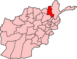
A Pakistani woman doctor is under investigation for her alleged involvement in poisoning school students in the Takhar province of Afghanistan.
(Image: wikimedia.org) Takhar Province (Click image for source)
Officials said they have arrested 11 suspects, including the Pakistani lady doctor, identified as Gulnaz, on charges of involvement in poisoning the students.
Gulnaz is said to belong to Punjab province. According to reports Gulnaz was working at a health clinic in Rustaq district, but did not have the required medical certificates.
She also did not have the documents required for a foreign doctor to work in Afghanistan.
In the meantime a provincial media representative speaking on the condition of anonymity said some suspects had been arrested in connection with the case.
He said the detained suspects also included a Pakistani woman doctor identified as Gulnaz and belonging to Punjab province.
�Yes, the authorities concerned are grilling Gulnaz but there is no proof of her involvement in the matter thus far,� he said adding that Gulnaz was working at a health clinic in Rustaq district in Takhar province.
She did not have the required medical certificates. He said Gulnaz also didn�t have the documents required for a foreign doctor to work in Afghanistan.
Parents are being warned about the importance of protecting their children against measles following an outbreak of the infectious disease in County Cork.
The Public Health Agency (PHA) is urging families to get their children fully immunised with two doses of MMR before travelling to the south of Ireland or to other European countries during the summer months.
The warning came after 51 children were diagnosed with measles in west Cork. Two of them were admitted to hospital for further treatment.
Most of the infected children are teenagers and 88% of them had never received any dose of MMR vaccine. Although measles can occur at any age, it is most common in children.
However, the disease is life threatening at any age.
Measles can be caught either through direct contact with an infected person, or through the air when the patient coughs or sneezes. Dr Gerry Waldron is Acting Assistant Director of Public Health (Health Protection) with the PHA.
He says it is never too late to get immunised.
“If children are not vaccinated they are left exposed to a serious and potentially fatal disease.
“MMR immunisation is the safest and most effective way to prevent measles infection and it is never too late to get vaccinated.”
Northern Ireland has high uptake levels for MMR, Dr Waldron said, before adding that this was a great tribute to the medical staff involved in the immunisation programme and also parents.
“MMR uptake rates are very high – just over 93% of children have received it by the age of two and by five years of age,” he said.
Monday, 11 June, 2012 at 13:26 (01:26 PM) UTC RSOE
Tropical Depression 05W rapidly accelerating WNW as it maintained its strength while over the Caroline Islands.
(Image: wikipedia.org) Map of Caroline Islands (Click image for source)
(Image: usno.navy.mil)
Tropical Depression 05W
(Click image for source)
At 0900 GMT/UTC 11 June 2012 Tropical Depression 05W was at 9.4º N 144.7º E, moving WNW @ 30 kph (16 kts), Winds 45 kph (25 kts) near the center, Gusts: 65 kph (35 kts) 1002mb
(Image: usno.navy.mil) Multispectral Satellite Imagery (Click image for source)
05W(UNNAMED) has intensified into a Tropical Storm…Guchol still on a westerly track towards Western Micronesia.
� Tropical Storm Guchol is forecast to enhance the Southwest Monsoon (aka. Habagat) Mindanao beginning Wednesday and across Visayas, Western & Southern Luzon incl. Palawan, Mindoro & Metro Manila this weekend. Breezy to windy conditions & cloudy skies w/ occasional to widespread rains, thunderstorms & squalls will be expected. The seas along the coastal areas facing the West Philippine and Visayan Sea will become moderate to rough.
Residents and visitors along Yap, Ulithi, Palau and the rest of Western Micronesia should closely monitor the progress of 05W (UNNAMED).
Do not use this for life or death decision. This advisory is intended for additional information purposes only. Kindly refer to your country’s official weather agency for local warnings, advisories & bulletins.
The crew on board the 22 Squadron RAF Valley Sea King hovered in thick cloud to rescue the 47-year-old man, who was suffering epileptic fits at the 3,560ft summit of Snowdon yesterday.
At one point they had to abort when the ground was no longer visible because of the cloud.
They “hover-taxied” along a ridge for 300 yards, barely able to see more than a few yards, and close to the summit a winchman was lowered to the man, who was being tended by two other walkers.
But a thick curtain of cloud quickly descended on the area, making it too dangerous to winch the sick man onboard.
He was carried on a stretcher to the Clogwyn station, about halfway down the mountain, where he was able to be winched to safety and flown to Ysbyty Gwynedd.
Rescue co-ordinator Elfyn Jones, of Llanberis Mountain Rescue Team said: “The helicopter did…
(Image: France24) One of the many joke images created by Iranians following the hoax. This one shows Ayatollah Khomeini sipping a Pepsi on the moon. (Click image for source)
On Tuesday night, thousands of Iranians looked up at the sky in the hopes of seeing the Pepsi logo appear on the moon.
In the past few days, rumors had swelled on Iranian websites and social networks, saying that Pepsi Co. was going to shoot powerful lasers at the moon to display the brand�s colors on its surface. Some took this as a joke; others believed it. Either way, many went up on their roofs to inspect the moon at the announced time. France24 Observers in Tehran tell more.
This hoax video purports to show the Pepsi logo projected onto the moon.
Five persons died and at least 40 others were injured when a bus carrying Vaishno Devi pilgrims plunged into a deep gorge near Katra.
(Photo: statetimes.in) Katra Bus Crash (click image for source)
The bus (number JK12 2193) was on its way from Udhampur to Katra. Reports said the driver failed to maneuver a turn near Panthel and the vehicle fell into a gorge.
The victims have been identified as Vijay Kumar, 51 (son of Tara Chand, resident of Katra), Devi Dass, 42 (son of Sidhu Ram, resident of Himachal Pradesh), Devinder Kumar, 26 (son of Sohan Lal, resident of Doda), Varsha Rajan, 24 (wife of VP Rajan) and Deepika Rajan, 4, (daughter of VP Rajan).
At least 25 injured passengers are undergoing treatment at Emergency Hospital, Katra.
Those critically injured have been shifted to the Government Medical College, Jammu. Jagjit Singh, DIG, Udhampur-Reasi range, is supervising the rescue work. – mhone.in
N. N. Vohra, Governor, has expressed serious concern and sympathy with all those who were injured in a major bus accident at Moori, near Katra, today and prayed for their speedy recovery.
The Governor, who is Chairman of the Shri Mata Vaishno Devi Shrine Board, has directed Dr. Mandeep K. Bhandari, Additional Chief Executive Officer of the Shrine Board, to provide medical and other required support to all those injured in this unfortunate accident. – dailykashmirimages.com
The State Times said that the driver and the cleaner fled from the spot.
The locals joined the police in rescue and relief operations. The injured have been shifted to Government Medical College Hospital, Jammu.
This is the second road mishap involving Vaishno Devi pilgrims.
On 9th May, 32 persons were injured when a bus they were travelling in had turned turtle at Moori area of Katra this evening.
The bus (UP86T-0824) carrying pilgrims of Mata Vaishno Devi, was on its way from Katra to Jammu when it met with the mishap at Moori area. Nine of the seriously injured passengers were referred to Government Medical College and Hospital Jammu for advanced treatment.
The accidents on the National Highway have touched alarming proportions in the recent years. The Doda-Ramban belt has been the worst sufferer. To suggest effective measures for checking road mishaps, a panel of the State Legislature had been constituted. The panel held several rounds of discussions and visited various places in� the erstwhile district to talk to various stake holders.
While most of the accidents have taken place due to rash and negligent driving, the lack of effective monitoring too has been one of the reasons behind accidents. In one of the accidents last month, a Sumo carrying double than its capacity passengers fell into a gorge in which 13 persons, including six children were killed. – statetimes.in
A section of a five-story apartment building collapsed in western Ukraine early Sunday, killing two people and
injuring one, officials said.
(Photo: Ukraine Emergency Situations Ministry)
Emergency workers helped 18 other residents, including a 4-year-old child, climb down from the balconies of eight apartments on the undamaged side of the building.
Other residents who escaped the disaster were being fed at a soup kitchen set up at the site by the emergency workers and many were being taken to a city hotel for lodging.
The cause of the disaster was not immediately known, but Ukraine’s Channel 5 TV said authorities suspect unauthorized repair work being done in the building’s basement.
Buildings frequently collapse in Ukraine, where infrastructure is outdated and safety rules are often neglected.
Sunday’s disaster occurred at about 4 a.m. in the western city of Lutsk, 150 kilometers (90 miles) north of Lviv city, which is currently co-hosting the European football championship.
The Emergency Situations Ministry said the kitchens and living rooms of apartments were destroyed when the load-bearing structure running through them collapsed.
Yekaterina Nakonechnaya, a resident whose husband was killed, said she and her daughter were talking in their apartment when they saw sand running out from beneath wallpaper. “I said: ‘Our flat is so old, it seems like mice are already living here.’ And as I was saying this, bang and that was it.” She said she survived in a corridor of the apartment and her daughter in the bedroom.
Television footage showed a giant gaping space in the gray building, which was constructed in 1971. Lutsk Mayor Mykola Romanyuk said the disaster could have been much deadlier if the bedrooms also had collapsed.
Sunday, 10 June, 2012 at 17:39 (05:39 PM) UTC RSOE
Flash flooding has hit a dozen properties in two villages near York, following torrential rain yesterday afternoon.
(Photo: yorkpress.co.uk) Firefighters pump water away from houses at Flaxton (Click image for source)
Five homes and a kitchen manufacturing business were inundated at Flaxton, while another six properties were flooded in Sandy Lane, Stockton-on-the-Forest.
Huge traffic jams also built up on the A64 between York and Malton because of flooding.
Flaxton resident Mark O’Brien said he drove back home through a huge hail storm. “The noise was unbelievable,� he said. �It was so loud in the car that we couldn’t talk to each other.” He said the flood waters rose to within inches of the floorboards at his home in Main Street.
A rain gauge kept by residents John and Sarah Jackson indicated that more than two inches of rain had fallen in the village. Mrs Jackson said: “The whole ground went white with the ice from the hail storm. I have lived here for 17 years and have never, ever experienced anything like this. There was thunder and lightning for over an hour.”
Fire station officer David Watson said the sheer volume of rainfall had been too much for the drains to cope with. He said firefighters using pumps had prevented more properties from being flooded.
Richard James Handmade Kitchens’ premises near the railway level crossing in Flaxton, were flooded to a depth of about two feet after a nearby beck burst its banks.
Proprietor Richard Patterson said about �100,000 worth of machinery was affected by flooding, along with bespoke furniture that was in the process of being manufactured. He said he would have to wait for the flood waters to recede before he could access the extent of the damage. He pledged to get the business reopened as quickly as possible,adding: “You can’t let the customers down.”
Sunday, 10 June, 2012 at 05:43 (05:43 AM) UTC RSOE
Forecasters say there will be scattered and slow moving showers in York, North Yorkshire and East Yorkshire, becoming heavy and thundery in the afternoon. – The Press, York
A passenger bus carrying mostly students fell off a narrow mountain road in western Bolivia on Thursday, killing eighteen people and injuring many more, local authorities said on Saturday. The road is often referred to as the world’s most dangerous.
The accident happened at around 3:30 p.m. local time on Thursday in La Paz province on the North Yungas Road, which is better known as the ‘Highway of Death’. The bus was traveling from the town of Irupana to the capital La Paz to participate in an inter-school sporting evening
A list of casualties released on Saturday showed eighteen people were killed, including 25-year-old bus driver Miguel Aliaga, 24-year-old support bus driver Cruz Aliaga Benique and at least four teenagers. Another 33 people aged between 2 and 51 were injured, some critically.
Police said the accident happened on a narrow dirt road when the passenger bus, which was operated by Trans Arenas and was also carrying regular passengers, suddenly tried to avoid an oncoming taxi. “A taxi came in front of us and our bus gave way, but it seems it went too far to the edge and fell,” one of the injured victims told local media.
Photos and videos from the scene showed most of the vehicle, which fell some 150 meters (490 feet), was destroyed and several bodies could be seen around the wreckage. Officials said many of the passengers were ejected from the vehicle while others were crushed by the bus, which was carrying around 60 people.
The North Yungas Road, more than 40 miles (65 kilometers) long, is infamously known as one of the most dangerous roads in the world due to its narrow dirt roads. The road, which is a major route for trucks and buses, is just three meters (9.8 feet) wide in many places. Many vehicles fall off the edge when attempting to overtake oncoming vehicles.
According to official figures, at least 42 people were killed on the road in 2011, but it is believed the actual figure is in the hundreds. Emergency services do usually not respond to accidents along the road unless it involves many casualties, and even then they are slow to respond as mobile phones do not work in the area. – Blottr
Other reports differ:
At least 16 people were killed and 32 others injured when a bus plunged into a ravine on the highway that links La Paz to Bolivia�s northern Amazon region, police and medical personnel said.
The accident happened on Thursday afternoon near Unduavi, a town about 46 kilometers (28 miles) from La Paz, when the bus went off the road and fell 120 meters (393 feet) to the bottom of the ravine, highway patrol chief Victorino Torrez told reporters.
�We have more than 16 dead, the highway patrol and the Bersa rescue team are working to recover the bodies,� Torrez said.
La Paz�s Arco Iris Hospital received 32 accident victims, with several listed in critical condition, hospital spokesman Dr. Fernando Arispe said.
The bus was carrying a group of students from Chicaloma, a town in Sud Yungas province, who were going to take part in a sports event in La Paz.
The government has been trying for years to reduce the number of traffic accidents in Bolivia.
President Evo Morales�s administration enacted a law in January 2010 that cracked down on bus drivers caught working drunk, inexperienced drivers and drivers who work excessive hours.
The measure�s goal is to reduce accidents, which kill an average of 1,000 people annually, according to International Automobile Federation figures, in this Andean nation. – hispanicallyspeakingnews.com
At least 16 youngsters were killed and 32 injured when their bus plunged into a 400ft ravine north of Bolivia’s capital La Paz on the way to a school sports event.
Transit police chief Victorino Torres said the death toll could rise because rescuers were still searching the wreckage in the Acero Marka district.
Mr Torres said the students were aged 16-18 and were travelling to La Paz to compete in an inter-school sports competition.
He did not say what caused the accident, but survivors said the driver tried to let another bus pass on the narrow road, then went into the ravine.
Hospital official Fernando Arispe said some of the 32 injured were in a “very serious” condition. – Virgin Media
A bus crashed in Bolivia, killing 18 people and injuring 41 others, officials said.
The accident happened around 3 p.m. Thursday near Unduavi, El Diario, of La Paz, Bolivia, reported.
The bus, owned by Eugene Arenas Aliaga Irupana, was heading to Entre Rios when it veered off the road and plunged 393 feet off a cliff, making it difficult for rescuers to reach the occupants immediately, the report said.
What caused the bus to veer off the road was not reported.
Many of the 18 who died were young people between the ages of 15 and 17 from the Education Unit of Chicaloma, officials said,
Those injured were brought to a hospital where doctors said at least two were in critical condition. – UPI


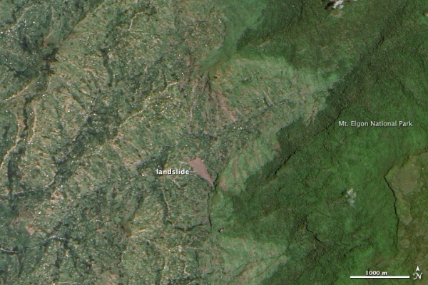


 cftc hus
  Shoko Tanaka 脱原発
  Natsu Tanaka 田中奈都
  Michael Haltman
  智美(反原発・即時廃止派/核全廃)
  Takayuki Akimoto